History
Most of Malabar District was included among the territories ceded to the British East India Company in 1792 by Tipu Sultan of Mysore at the conclusion of the Third Anglo-Mysore War; Wayanad was ceded in 1799 at the conclusion of the Fourth Anglo-Mysore War. The region was organized into a district of Madras Presidency. The administrative headquarters were at Calicut (Kozhikode). After Indian independence, Madras Presidency was reorganized into Madras state, which was divided along linguistic lines on November 1, 1956, when Malabar District was merged with the Malayalam-speaking Kasaragod District immediately to the north and the state of Travancore-Cochin to the south to form the state of Kerala. Malabar District was divided into the three districts of Kozhikode, Palakkad, and Kannur on January 1, 1957. Malappuram District was created from parts of Kozhikode and Palakkad in 1969, andWayanad District was created in 1980 from parts of Kozhikode and Kannur.
The name Malabar was not in general use until the arrival of the Europeans. The word is most probably the fusion of the Dravidian Mala (Hill) and Puram (region) derived or westernized into bar. Malabar may so be taken to mean the hill country, a name well suited to its physical characteristics.
[edit]Geography
The district was widely scattered and consists of the following parts:-
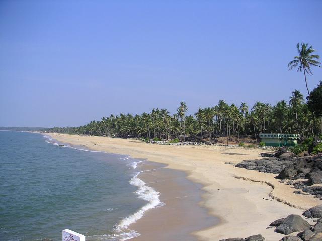
- Malabar Proper extending north to south along the coast, a distance of around 240 kilometer, and lying between N. Lat 10° 15′ and 12° 18′ N and E.Long. 75° 14′ and 76° 56′.
- A group of nineteen isolated bits of territory lying scattered, fifteen of them in the native state of Cochin and the remaining four in those of Travancore, but all of them near the coast line. These isolated bits of territory form the taluk of British Cochin.
- Two other detached bits of land within the Travancore.
- Four inhabited and ten uninhabited islands of Lakshadweep. The four inhabited islands are: Agatti, Kavaratti, Androth, and Kalpeni.
- The solitary island of Minicoy.
[edit]Taluks
- Calicut (Area:379 square miles (980 km2); Headquarters:Calicut)
- Chirakkal (Area:677 square miles (1,750 km2); Headquarters:Chirakkal), now Kannur
- Cochin (Area:2 square miles (5.2 km2); Headquarters:Cochin)
- Ernad (Area:979 square miles (2,540 km2); Headquarters:)
- Kottayam (Area:489 square miles (1,270 km2); Headquarters:Kottayam), now Talassery
- Kurumbranad (Area:505 square miles (1,310 km2); Headquarters:),now Vadakara
- Laccadive Islands (Headquarters:Kavaratti)
- Palghat (Area:643 square miles (1,670 km2); Headquarters:Palghat)
- Ponnani (Area:426 square miles (1,100 km2); Headquarters:Ponnani)
- Valluvanad (Area:882 square miles (2,280 km2); Headquarters:), now Perinthalmanna
- Wynad (Area:821 square miles (2,130 km2); Headquarters:Kalpetta)
[edit]Today's Taluks in erstwhile Malabar
Kannur District:
Wayanad District:
Kozhikode District:
Malappuram District:
Palakkad District:
Thrissur District:
Note: Kasaragod and Hosdurg taluks in Kasaragod district is sometimes considered as part of Malabar region, however not part of erstwhile Malabar district.
[edit]Representatives from Malabar to Madras State
- In C. Rajagopalachari Ministry: 1) Kongattil Raman Menon (1937–39), 2) C. J. Varkey (1937–39)
- In Prakasam Ministry: 1) R. Raghavamenon (1946–47)
- In Ramaswami Reddyar Ministry: 1) Kozhippurathu Madhavamenon (1947–49)
- In P. S. Kumaraswami Ministry: 1) Kozhippurathu Madhavamenon (1949–52)
- In C. Rajagopalachari Ministry: 1) K. P. Kuttikrishnan Nair (1952–54)